Fridays are about Mineral King

By Mineral King standards, Soda Springs is a short hike. In fact, we call it a “walk”. It is all a matter of one’s perspective. I think it is 3 miles round trip and is mostly level.

If you are used to towering peaks, majestic canyons, blowing erupting fountains, roaring waterfalls and the like, this is no big deal.

If you just want to take a nice walk in the mountains and end up by a weird little orange hole of water, then Soda Springs is your walk.

Almost all walks require crossing the bridge. If you are familiar with this view, you might be wondering why there are no dead branches in the upper left corner of the photo. Wonder on. . .

After crossing Crystal Creek, the trail splits.  You take the right fork, unless you are going somewhere else like Farewell Gap or Franklin Lake.

After another 1/4 or 1/2 mile, you see this view and know you are almost there. Those are aspen trees below the conifers (which means cone shaped trees that produce cones)

Told you Soda Springs is an orange hole of water! It bubbles up from the ground, and has a slight carbonation. Some folks like to mix it with various powdered flavored drink mixes. I think it taste like fizzy metal, so I carry my own normal water to drink.

The flow pattern of Soda Springs changes from year to year. I don’t know why. Some things just are, like orange holes of water that draw us back, year after year.

Summer of Animals?

This summer is shaping up to be full of wild animals for this California artist.

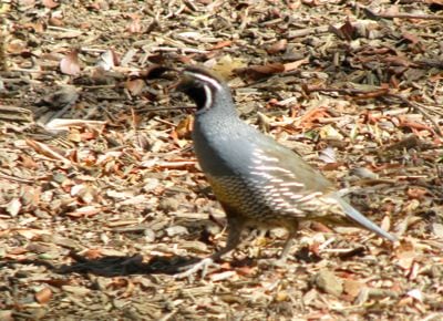
First, we were hiking in Mineral King and saw this:

While on that hike I thought of doing these oil paintings:

They are each 4×4″, and from left to right are a mule deer buck, golden mantle squirrel, yellow-bellied marmot, and a black bear. (They are called that even when they are brown or cinnamon or blond.)

After that, I painted this bear for the Sierra Lodge in Three Rivers:

After which, they asked me to refresh this bear:

So that he would look like this:

With all that wildlife around, particularly the ferocious bear, you might be a bit concerned about unfriendly encounters or a bit of danger. There was one small incident that ended up looking like this:

I love teal. It looks particularly striking with brown.

P.S. The bear on the flag of this California artist’s state is a grizzly, not a black bear. I’m happy to report we don’t have them in California any more. This is not an environmentally correct view, but I am more concerned with personal safety than being correct. This might make me a pig. See? animal summer!

Mineral King

As promised, Fridays are for Mineral King.

White Chief is a short but very steep hike.

The largest patch of snow is called “Bearskin”. It is on the side of Vandever Mt. and probably won’t make it until the snow falls in Autumn this year. Some years it does, and other years it does but binoculars are required to prove it.

Perhaps Retired Road Guy should now be called "Trail Guy".


White Chief sink hole

There are about 5 of these in the White Chief canyon. In person, they are quite interesting (maybe it is the lack of oxygen there that makes me think so). They photograph poorly, as you can see. If Trail Guy was down in the hole, you’d get a better idea of the scale, but you can see in the photo above that he was busy with lunch.

Pussy Paws

These are boring flowers that seldom show up against the dirt and gravel. The Artspeak explanation is that they are the same value as the dirt, so there is no contrast. This particular patch was unusually bright.

This photo took forever. The flutterby was a bit too fast for my shutter-finger, and I was thankful to not be wasting film!


Mineral King

Summer has arrived in Mineral King. For those of you who are new to the blog or not from the area, Mineral King is a section in the southern end of Sequoia National Park, California. It is reached by a long and winding road, 25 miles, sometimes unpaved, somewhat cliff-hanging, often one or perhaps one and a half lane wide, with a recommended driving time of one and a half hours.  (It doesn’t take me that long. Just sayin’. And stay on your side, please!)

There is no electricity in Mineral King. The elevation is 7800′. Our cabin has running water (from a stream), hot water (propane), a very old propane refrigerator, a wood stove for cooking and heating, and a fireplace for heating in extreme conditions such as Memorial Day weekend. (We even have a telephone, no answering machine, and when 10 people have the number and use it regularly, we change the number.)

Mineral King is a source of great inspiration to me. I often refer to it as The Land of No Electricity, and I spend as much time as I can there in the summer.

I’ve decided to do my “reporting” on Mineral King on Fridays on this blog. That way, if you only tune in for Mineral King, you will know which day to check in. Conversely, if you don’t give a rodent’s hiney about this place in Sequoia, you will know which day to tune out.

Farewell Gap
Evening LIght in Mineral KIng
Pond by White Chief with view of Mineral Peak and Sawtooth
Someone Else's Mineral King Cabin
Another Mineral King cabin, not mine
Where my friends Judy and Tim got married in Mineral King


Where do you get your inspiration?

Is There An Echo In Here??

What is the visual equivalent of an echo? A shadow? A reflection, perhaps. . .

Is there a reflection in this studio? A reflection of Mineral King, to be exact? Because I see an awful lot of Mineral King Oil Paintings drying on your wall!

Seems that way. Mineral King is de ja vu all over again.

Same scene, different viewpoints.

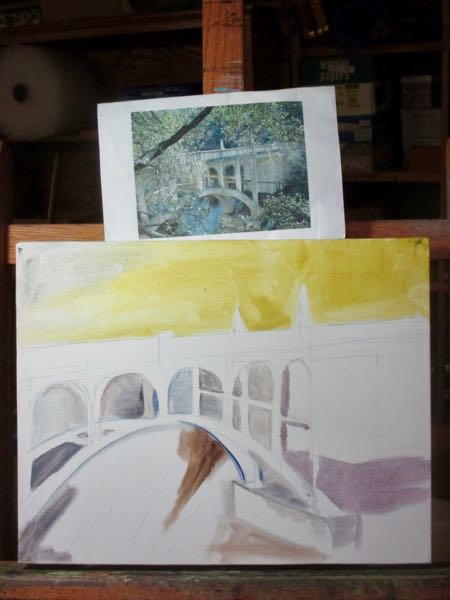
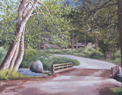
Same bridge twice, different paint jobs, different directions.

Same cabin, different times of day, different times of year.

Same place, favorite view, over and over and over. Mineral King oil paintings, on miles and miles of canvas. Mineral King, Farewell Gap, over and over and over. Instead of the California artist, I am the Mineral King artist. Perhaps I should change my tagline in this blog.

Nope. Oranges and poppies don’t grow in Mineral King.

Are you tired of this view yet? (that question is for you, the reader, not me, the California Artist!) Tell me about it here.

Memorial Day Weekend in Mineral King

Wow. Mineral King on Memorial Day weekend has a reputation for being cold. It was 27 degrees much of the time. I’m not making this up. Here, see eleven photos with an occasional comment. (What? you expected me not to have an opinion??)

Loved the backpacks collecting sunshine beneath the flag. We always fly the flag when we are at the cabin. It is a Mineral King tradition, and we are just following suit, because, well, lots of reasons.

The sunshine was short lived. It turned to rain. Very cold rain.

The next morning I looked out the window at this view. “Hey Honey, you going riding?”

“Uh, no, gotta find some firewood so we can keep warm and make coffee.”

“Okay, I’ll just stay inside and look out the window and load up the wood stove and the fireplace and take photos out of the window and dream of summer.”

Mineral King cabin


I did take a brief walk. Very brief.

Mineral King Honeymoon Cabin

Mineral King, Farewell Gap

That’s Retired Road Guy and Cowboy Bert

Then the sun came out and it was still cold!

Sunshine on my flag!

Did you spend Memorial Day weekend in a memorable manner with a flag?

Behind the Scenes of the Sequoia Mural

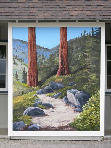
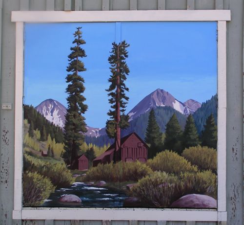
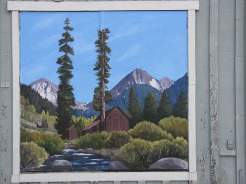
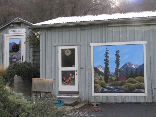
The customer asked for a mural, explained the nature of her business, and I said, “A mural of a trail would be just right!” (Sequoia Outdoor Sports will be renting camping and backpacking gear to visitors to Sequoia National Park.)

I brought several photos and paintings of trail scenes with me to meet the owner (John) and the manager (Carolyn) and see the wall.

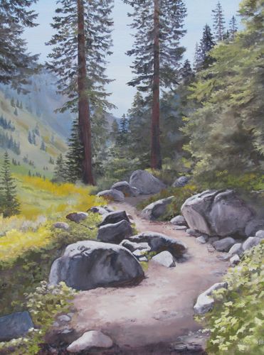
John loved this painting.

Mosquito Lake Trail, 16×20″, oil on wrapped canvas, $350

John asked if I could substitute Sequoia trees for the red firs. I said yes, but. Yes, but there are no Sequoia trees at that elevation or in Mineral King. John said it wouldn’t matter to his customers, who will primarily be Europeans who come to see the Big Trees.

John is the customer. He is right! 

Today a man stopped by to ask if I was tagging his building. He was joking. He is the leaseholder of the building. Then he said, “Is that the trail to White Chief and Mosquito Lakes?” Ummm, yes, sort of. In spite of the fact that I changed the background to be more congruent with a place that would have Sequoia trees, he knew the trail!

Three Rivers locals will recognize the incongruity but they will be polite. If John is happy and his customers are happy, then I am happy.

First mural, revisited

Back when I decided to begin muralizing, I started by painting Farewell Gap in oils and increasing the size each time. After I completed a 24×36″, it was time to paint it on my workshop doors. This was the first time I painted large and it shocked me how quickly it went. Michael stood back and helped me with the shape and scale of the peaks. Louise stood down the driveway and coached me on the water. This is how it looked in April 2008.

The colors faded, and I paint better now. Besides, the Three Rivers  Studio Tour is coming in March 2012, so it is time to repaint.

Now, I can see that the poppy door is faded too. Is this going to be like painting the Golden Gate Bridge?

Weird Winter Walk, part 3

As we descended the non-maintained trail from Monarch, this was our view of Sawtooth Peak. If you aren’t familiar with it, the view here might help you.

Michael referred to this as the “moonscape”.

“. . .miles to go before I sleep.”

Nice light, eh?

Sometimes we lost the trail because we were avoiding stuff like this.

When I told Michael to look at the way these spires were lit, he said, “I’ll fall over if I look up!”. Speaking of falling, I did fall a couple of times. This is the first time in my memory that my knees and ankles just spontaneously buckled.

In the summer, we rarely choose to use the Sawtooth/Timber Gap trail. It is steep, hot, and dusty. On our trip down from Monarch, it was the most welcoming and comfortable part of the day. Because of freeze-thaw, the trail bed was a little spongy and not dusty at all. It wasn’t steep compared to the rest of the hike, and such a nice flat place to put one’s feet! Good thing, because we were on the edge of running out of daylight and needed to pick up the pace.

Michael took this photo of Empire and Sawtooth Pass while shouting at me to hurry up in the outhouse. I did hurry, but not soon enough to run down the icy slick road for a better view of the entire peak. It was truly this red, and only lasted about 1 minute.

Dang. That was a hard day. Michael asked me what the best part was, and I said “the sunset”.